• Home
  • Destinations
    • Austria
    • England
    • France
    • Greece
    • Seychelles
    • Spain
    • Tanzania
  • Blog
  • Contact

salfeinersee-hike-innsbruck
Austria
Austria

Salfeiner See & Grieskogel in Austria: A Complete Hiking Guide

September 13, 2023

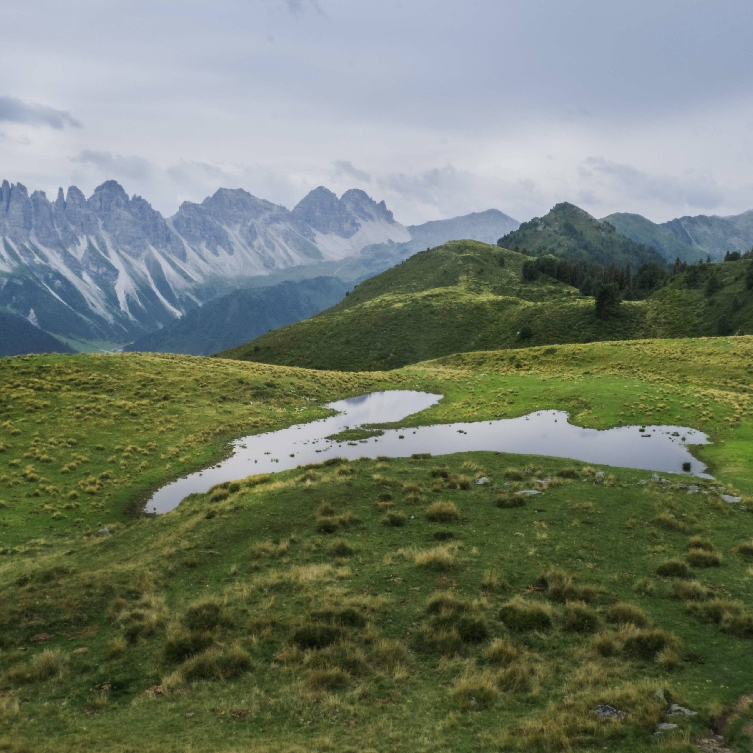
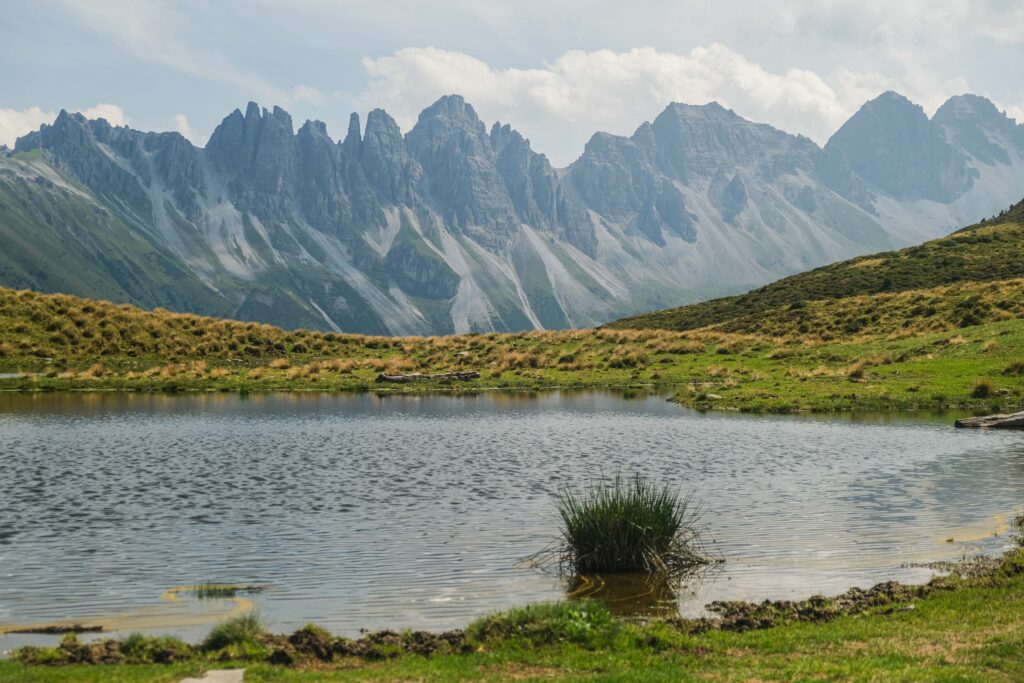
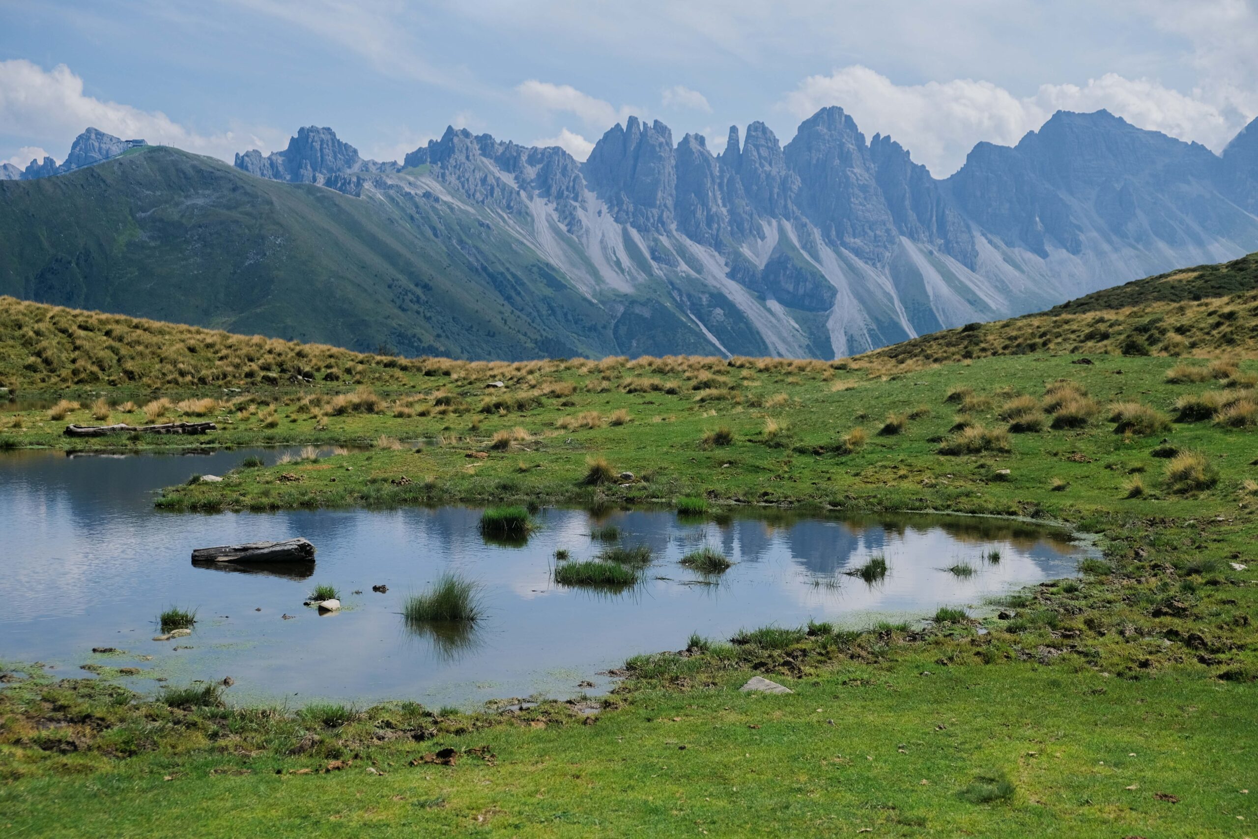
In the heart of summer, it becomes a mirror reflecting the towering majesty of the surrounding mountains. The result? A visual symphony of nature’s finest artistry, where the quietude of the lake serves as the canvas for the stunning play of light and shadows cast by the craggy peaks of the Kalkkögel Mountains.

But the adventure doesn’t end at Salfeinersee. A hike to this secluded spot is also your gateway to the nearby summit of Grieskogel that promises panoramic views stretching all the way to Innsbruck. The journey to the summit is a rewarding experience in itself, as you navigate through meadows painted with wildflowers and ascend to a vantage point where the beauty of the surrounding landscape unfolds in all its glory. 

So, if you’re a seeker of quieter adventures, a lover of reflections and serene moments, or simply in search of a different kind of alpine experience, Salfeinersee awaits your discovery. 

wta post divider

Salfeinersee Hiking Map & Overview

— HIKE OVERVIEW —

wta read more map

| Difficulty: moderate (extended route: hard)
| Trailhead: Parkplatz Kaserl
| Distance: 9.2km (extended route: 15.7 km)
| Time Needed: 4h (extended route: 6h 20min)
| Elevation: 650m (extended route: 970m)
| Where to Eat: Kemater Alm
| Where to Stay
: Kemater Alm, Altstadthotel Weißes Kreuz, Weisses Rössl, STAGE 12 Hotel by Penz
| When to Visit: June to September

wta post divider
salfeinersee DSF0083 scaled
salfeinersee DSF0072 scaled

How to Get to the Salfeinersee Trailhead 

The trailhead to Salfeiner See (Salfeinssee) starts at the “Parkplatz Kaserl”, the car park located near the bridge over the Senderbach river. The parking is approx. 15 minutes’ drive along the forest road from the village of Grinzens, nestled in the south-west of Innsbruck. 

If you have your own vehicle, you can enjoy a seamless drive directly to the trailhead, albeit after paying a toll fee for the forest road. Bus is another option but it will drop you off in the village center, 4km away from the trailhead, so be prepared for a bit of extra walking if you choose this option.

salfeinersee DSF0080
salfeinersee DSF0102

By Car

To reach the Kaserl Parking from Innsbruck, follow the route that passes through Grinzens, leading you toward the forest road. Keep in mind that this road is open seasonally, and there is a toll fee of 5 euros. While parking at the Kaserl Parking is free, it’s important to ensure that you place the toll ticket behind your windshield in a manner that makes it clearly visible from the outside.

You can conveniently purchase your toll ticket either by card or with cash at the automated payment machine located just before the barrier. Once you have your ticket, present the QR code to the barrier terminal, and it will smoothly lift, granting you access.

wta tip

During our visit, we encountered a minor issue where the barrier did not function as expected, despite having purchased and presented our ticket. In such cases, don’t fret. Just look for the Kemater Alm phone, often marked by a signpost nearby, and give them a call. The manager will promptly assist by opening the barrier, ensuring your journey continues without any hitches.

salfeinersee DSF0168

By Bus

Grinzens is easily accessible from Innsbruck with a quick 30-minute bus ride. Simply catch Bus #404, departing every 15 minutes from just outside the Innsbruck train station (Busbahnhof Steig K) and get off at the Grinzens Abzw Kemater Alm stop. A mere €4.00 will secure your ticket, available for purchase either online here or directly from the bus driver.

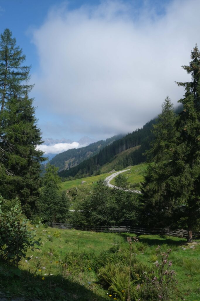
From the bus stop, follow the signs directing you to “Kemater Alm” and “Adolf-Pichler-Hütte,” and take a gentle 200-meter uphill stroll along the tarmac road. As you proceed, the road will gradually level out and transition into a forest road that meanders straight through the picturesque Senderstal Valley. This route will guide you through verdant meadows and pastures, all while ascending gently until you reach the Kaserl parking lot, your gateway to the Salfeinersee adventure.

wta post divider
salfeinersee DSF0045
salfeinersee DSF0213
salfeinersee DSF0196

The Hike to Salfeinersee & Grieskogel

Below, you’ll find a guide to the Salfeinersee and Grieskogel summit hike, organized into four distinct stages: an initial trek from the trailhead to the lake, followed by an ascent to the Grieskogel summit, a descent to Kemater Alm, and a return to the trailhead. The journey to the lake is suitable for families, while the ascent to Grieskogel, although not overly challenging, involves steep terrain.

For those eager to explore the neighboring summit, we have also included an extended route option. The sole variation is that instead of descending directly from Grieskogel to Kemater Alm, you’ll embark on a “ridge route” that leads past three additional summits.


salfeinersee DSF0065
salfeinersee DSF0128

| Stage 1 – To Salfeiner See |

2.6km
1h 30min
Ascent: ca. 510m 
Map
2.6km
1h 30min
Ascent: ca. 510m
Map

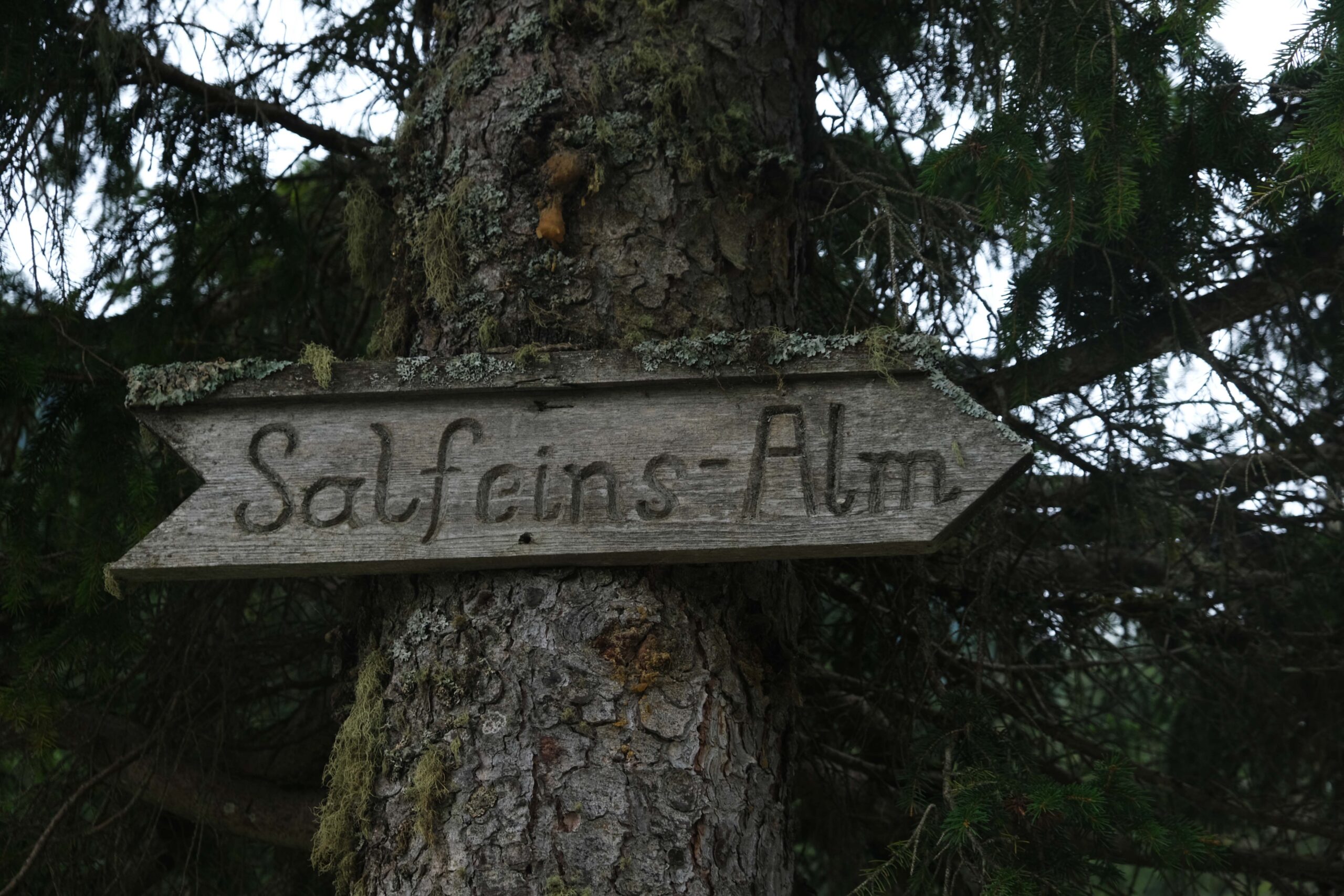
Begin your hike at the parking lot, located at an elevation of 1463 meters. Look for the signpost marked “Salfeins Alm, Salfeins” and make your way across the bridge spanning the Senderbach stream. Initially, you’ll follow the forest road uphill for a brief stretch and after a few meters beyond the first left turn, you’ll encounter a shortcut path. 

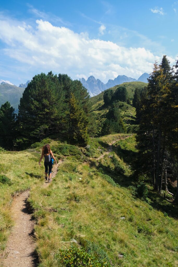
This path leads you through a scenic combination of meadows and forests, ultimately guiding you to the quaint Salfeinsalm at an altitude of 1738 meters. Here, you’ll stumble upon a petite wooden hut, although it’s worth noting that it is currently not in operation.

border brush 1
salfeinersee DSF0140

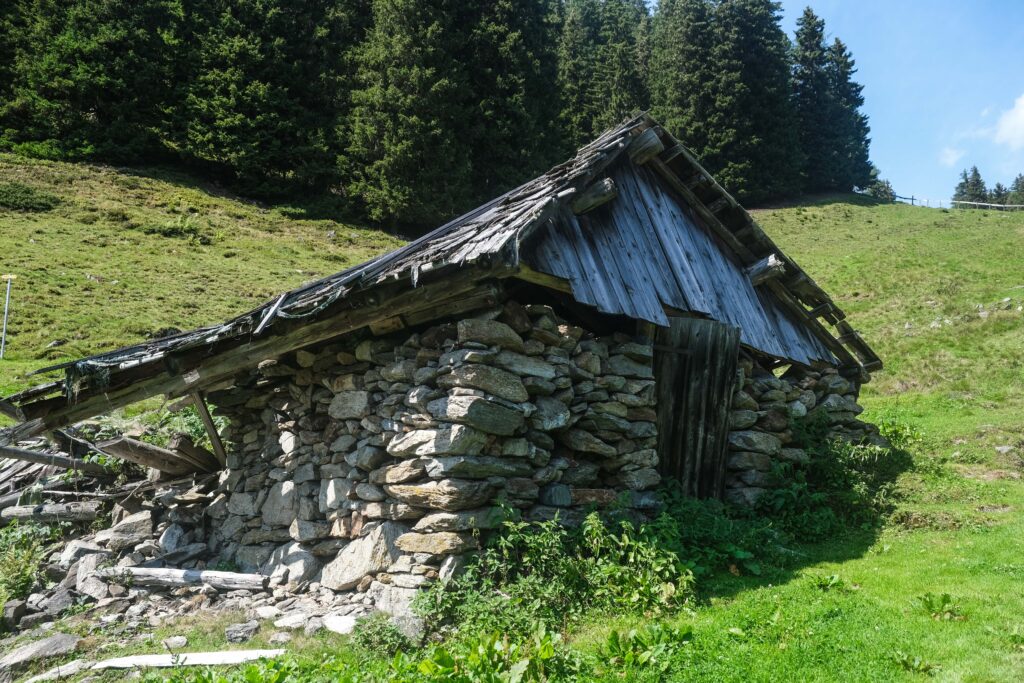
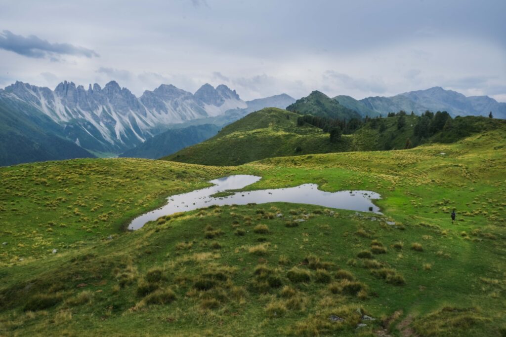
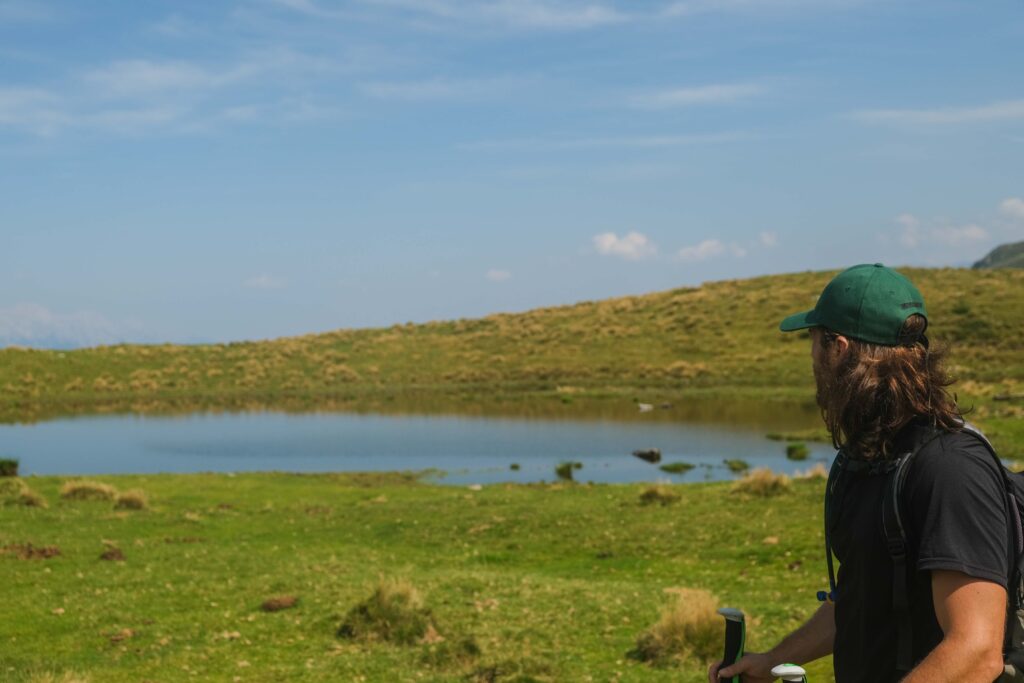
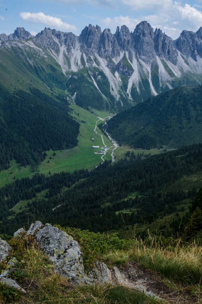
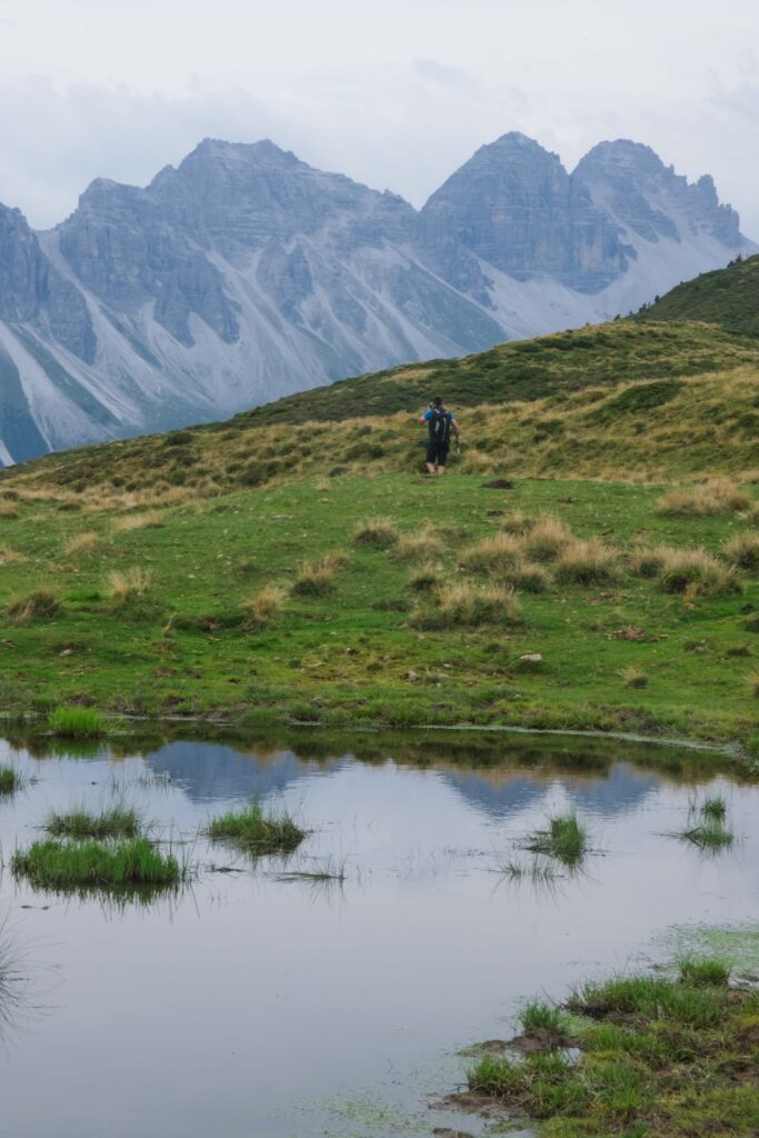
Leaving the alpine pasture behind, continue your ascent by moving diagonally upwards. Along the way, you’ll pass by the remains of a stone hut, a poignant testament to the area’s history. Keep your course westwards, and you’ll find yourself traversing a charming hollow before emerging onto a plateau that boasts Salfeinssee, a small but picturesque alpine lake. Perched atop the hill, a modest summit sign marks your accomplishment.


salfeinersee DSF0007
salfeinersee DSF0033

| Stage 2 – To Grieskogel |

1.6km
40min
Ascent: ca. 140m 
Map
1.6km
40min
Ascent: ca. 140m
Map

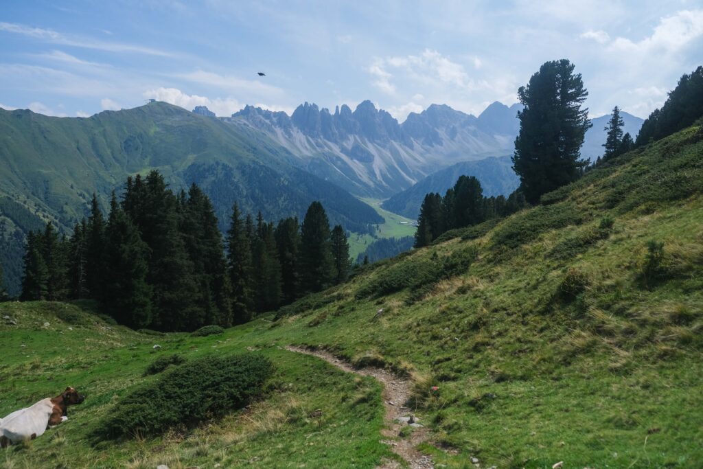
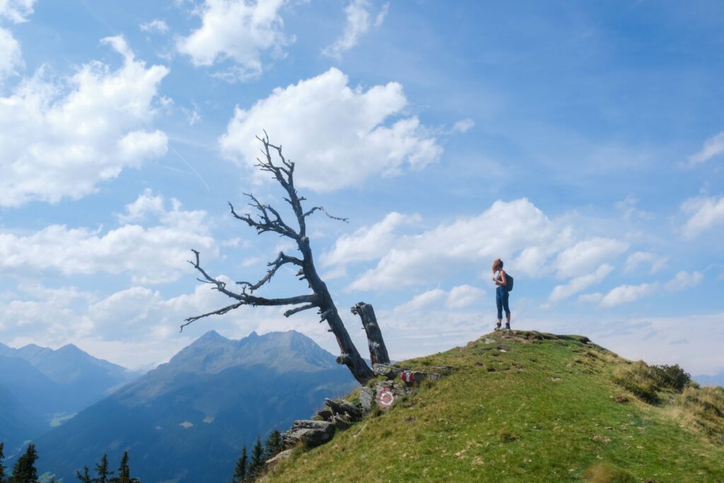
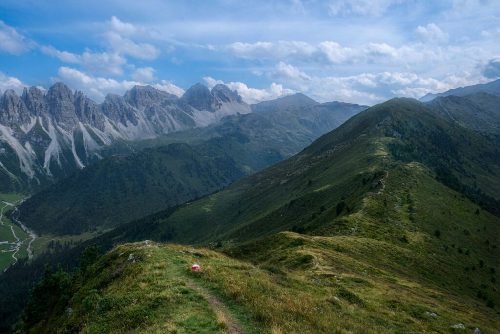
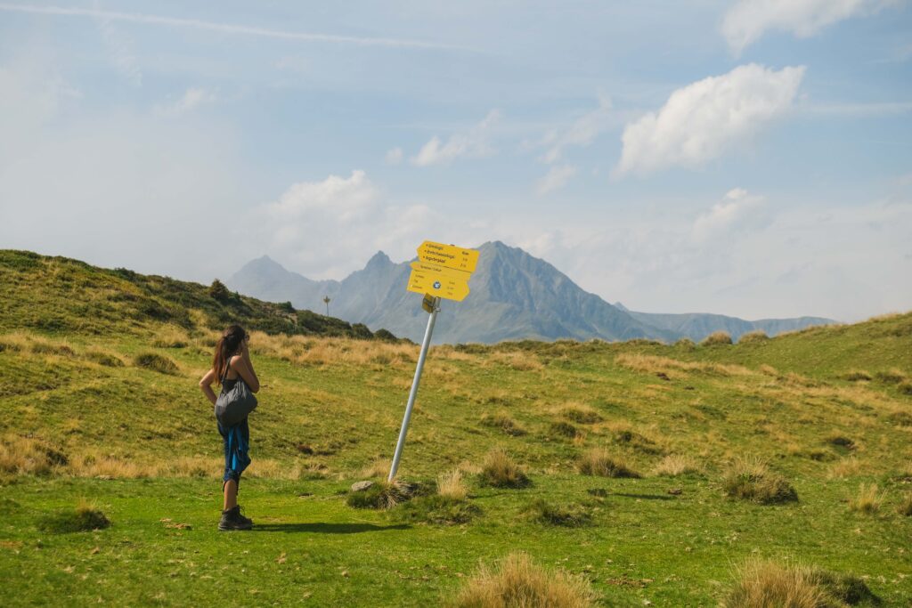
Departing from the small lake, your path unfolds as you follow the signpost that points the way to “Grieskogel, Breitschwemmkogel, Angerbergkopf.” Take a left turn onto a narrow ridge, where a weathered tree provides an ideal photo opportunity. From this vantage point, your gaze extends as far as the majestic Zugspitze, the picturesque Fotscher Tal, and down into the enchanting Sellraintal valley.

salfeinersee DSF0271

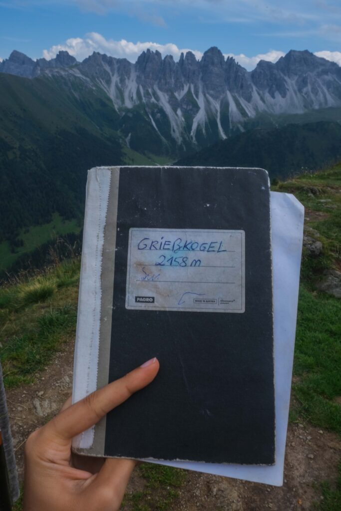
The trail, at times hugging the ridge’s crest and at others veering to the right, guides you through the lush wooded western flank of the mountain. Beyond a saddle, the ascent becomes somewhat steeper as you navigate open terrain, ultimately leading you to the summit cross atop Grieskogel, standing tall at an elevation of 2158 meters.

Enjoy the views and don’t forget to locate the hidden summit box, where you can inscribe your name in the book tucked away within, a cherished tradition among fellow adventurers.

wta read more map

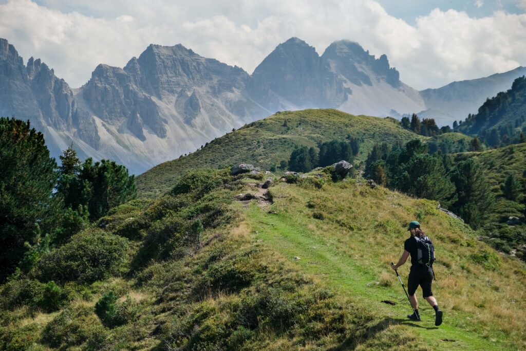
From this point, you have the option to descend towards Kemater Alm or to proceed along the ridge, traversing the summits of Breitschwemmkogel and Angerbergkopf, ultimately leading to the Schaflegerkogel peak. The latter represents the alternative extended route, and detailed information about it can be found below.


salfeinersee DSF0288

| Stage 3 – Down to Kemater Alm |

3.1km
1h 15min
Descent: 480m 
Map
3.1km
1h 15min
Descent: 480m
Map

From the summit of Grieskogel, embark on a brief descent to the adjacent saddle. Shortly after this point, you’ll reach a fork in the trail. Opt for the path to your left, clearly marked with signage, which leads you on a direct descent to Kemater Alm (1673 m).


salfeinersee DSF0037
salfeinersee DSF0112

| Stage 4 – From Kemater Alm to the Trailhead |

1.9km
30min
Descent: 190m 
Map
1.9km
30min
Descent: 190m
Map

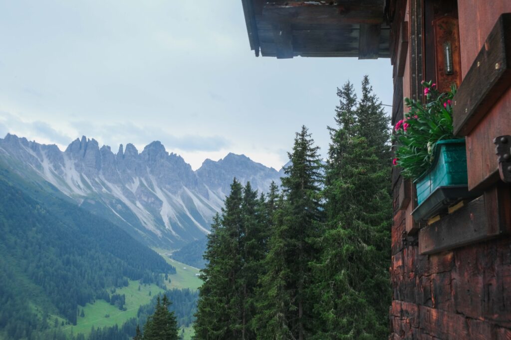
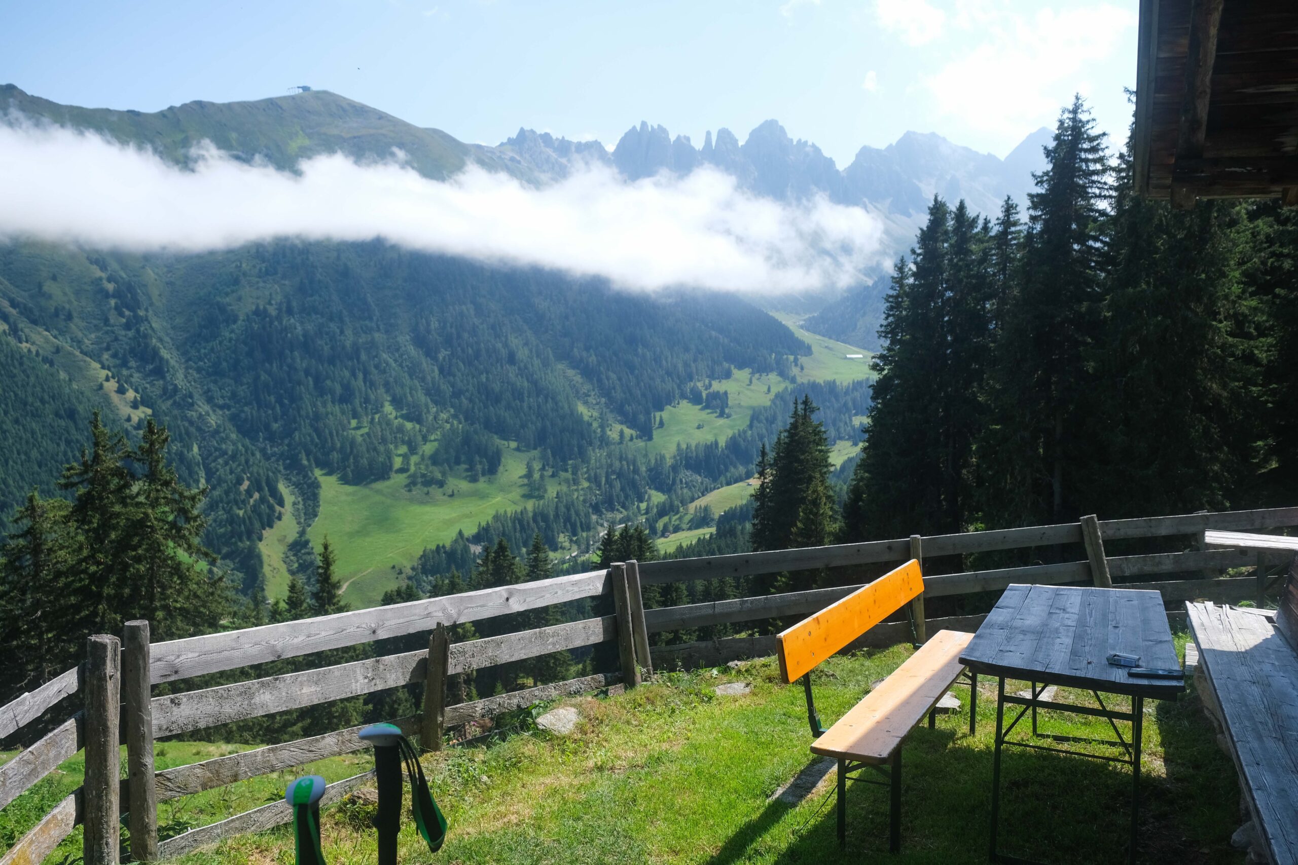
Savor your visit to Kemater Alm, an idyllic, traditional wooden hut nestled at the base of the magnificent Kalkkögel Mountains. Here, you can relish hearty cuisine and refreshing beverages.

After your break, follow the wide forest road that traces the scenic Senderbach river, leading you back to the trailhead, “Parkplatz Kaserl” car park. Covering a distance of approximately 2 kilometers, this leisurely stroll should take no more than 30 minutes to complete.

wta post divider
border brush 1
salfeinersee DSF0019

ALTERNATIVE (EXTENDED) ROUTE

This serves as an alternative trail tailored for those eager to explore the nearby summits. Along this route, you’ll journey southward from Grieskogel towards Breitschwemmkogel (2,264 m) and Angerbergkopf (2,399 m). After a brief descent and subsequent ascent to Schaflegerkogel (2,405 m), you’ll eventually make your way down to Kemater Alm. This particular route is clearly marked in orange on our map above.


salfeinersee DSF0194
salfeinersee DSF0094

| Stage 3A – Off to Schaflegerkogel |

4.1km
1h 40min
Ascent: 310m 
Map
4.1km
1h 40min
Ascent: 310m
Map

Following a brief descent from Grieskogel, you’ll come upon a trail fork. Here, choose the path that continues straight ahead, leading you over the ridge to the south. Your next summit destination, Breitschwemmkogel (2264 m), swiftly comes into view. 

Beyond it, the ridge takes on a rockier character, occasionally requiring you to traverse the slope sideways. The path alternates between steady ascents and descents until you ultimately arrive at the steel cross marking Angerbergkopf (2399 m), attained after a somewhat more strenuous climb.

The final leg towards Schaflegerkogel (2405 m) beckons, with an initial descent through grassy terrain followed by an ascent to a trail junction that leads left to the nearby summit cross.


salfeinersee DSF0315
salfeinersee DSF0336

| Stage 3B -Down to Kemater Alm |

5.5km
2h
Ascent: 700m 
Map
5.5km
2h
Ascent: 700m
Map

Starting from Schaflegerkogel, you’ll descend along a narrow path, navigating steep and occasionally rocky terrain, leading you to Kreuzjöchl. Here, you’ll intersect with the connecting trail from Potsdamer Hütte to Senderstal valley, and your journey continues downhill. 

The path gracefully winds its way through terraced meadows, gradually descending to the valley floor (1950 m), where a wooden footbridge spans the Sendersbach stream. Upon crossing to the other side, you’ll find a well-maintained track that offers a comfortable stroll out of the valley, eventually leading to Kemater Alm (1673 m).

wta read more map

From Kemater Alm follow the trail described above (Stage 4) to get back to the trailhead. 

wta post divider
salfeinersee DSF0229 scaled
salfeinersee DSF0121 scaled

Where to Stay & Eat near Salfeinersee 

When it comes to finding accommodation in the vicinity, you have a few appealing options to consider. The charming holiday resort of Axams is conveniently located just 2 kilometers away from Grinzens. Alternatively, if you’re looking for a more vibrant atmosphere, the bustling city of Innsbruck is a mere 15-kilometer drive away. In Innsbruck, you’ll find a selection of highly recommended hotels, including  Altstadthotel Weißes Kreuz, Weisses Rössl, STAGE 12 Hotel by Penz, and NOAS Home.

For those who prefer the rustic charm of a mountain hut, Kemater Alm, is conveniently located along your hiking route, offering an authentic alpine experience. Additionally, the Adolf Pichler Mountain Hut, while requiring a slight detour, is another appealing option. Keep in mind that mountain huts tend to be in high demand during the summer months, so it’s advisable to secure your reservation well in advance if you plan on spending the night.

wta tip

Even if you decide not to stay overnight at the huts, be sure to make a pit stop to savor mouthwatering Tirolean specialties such as Knödel (dumplings), Käsespätzle (cheese noodles), or Kaiserschmarrn (a delicious dessert). After a long hike, these delectable dishes always seem to taste even better when enjoyed at the mountain huts!

wta post divider
salfeinersee DSF0323
brush vv beige

When to Hike to the Salfeinersee 

To ensure a smooth hiking experience to Salfeinersee, it’s essential to consider both the accessibility of the forest road and the weather. 

The forest road typically opens in conjunction with the Kemater Alm hut’s operating hours, generally spanning from late June to early September. However, be aware that it is contingent on weather conditions. To avoid any inconvenience, especially the prospect of a 4-kilometer trek from the village to the trailhead, it’s advisable to contact Kemater Alm before setting out to confirm the forest road’s status.

salfeinersee DSF0055
salfeinersee DSF0068

As for the ideal time to visit Salfeinersee, summer is undoubtedly the prime season. However, be prepared for the unpredictable nature of Austrian Alps weather during this period. While most days offer brilliant sunshine, occasional brief rain showers can occur. So always check with a weather app before embarking on your hike. 

And if you are feeling more adventurous and seeking a unique experience, venture on a sunrise hike. The view of Innsbruck adorned with the mesmerizing colors of the dawn sky, as well as the reflections of the towering mountains in the serene lake, craft a stunning spectacle that’s absolutely unforgettable!

wta post divider

If the Austrian Alps have captured your heart and you’re eager for more captivating adventures, why not explore further? Delve into the beauty of alpine lakes like Drachensee and Seebensee, or embark on the breathtaking hike to the Olpererhütte and its awe-inspiring Suspension Bridge! The wonders of the Alps await your discovery.

TAGS:Hiking
0 Comments
Share

You May Also Like

The Best Things To Do In Alpbach, Austria

November 12, 2022

Wolfsklamm Gorge in Austria: A Complete Hiking Guide

November 18, 2020

Seebensee & Drachensee Lakes in Austria: A Complete Hiking Guide

January 4, 2019

Leave a Comment Cancel Comment

Previous Post
Olpererhütte & Suspension Bridge in Austria: A Complete Hiking Guide (& Map)
Next Post
Hirschebensee & Plenderlessee in Austria: The Best Hike in Kühtai
hi there and welcome!
Get To Know Us

Get To Know Us

Wanderers delight in taking wrong turns and creating beautiful memories from unexpected adventures. Join us on our journey. Let's explore the world together.

Stay in the Know

Ideste faucibus nisl tincidunt eget nullame none nisi est sit. Nibh cras pulvinar mt augue interdum velit. Pretium nibh isume vel pretium.

Instagram

  • 37 1
  • 34 1
  • 31 1
Hiking across waterfalls to reach the stunning Sulzenauhütte and the serene Blaue Lacke in Tyrol🤩
.
.
.
.
.
.
.
#hikinginaustria #sulzenauhütte #austriahiking #waterfallhike #exploreaustria #austriamountains #alpinehiking #stubaialps #mountainadventures #travelaustria #blauelacke #visittyrol #wrongturnagain #naturelovers
wrongturnagain
wrongturnagain
•
Follow
Hiking across waterfalls to reach the stunning Sulzenauhütte and the serene Blaue Lacke in Tyrol🤩 . . . . . . . #hikinginaustria #sulzenauhütte #austriahiking #waterfallhike #exploreaustria #austriamountains #alpinehiking #stubaialps #mountainadventures #travelaustria #blauelacke #visittyrol #wrongturnagain #naturelovers
10 months ago
View on Instagram |
1/6
“As the saying goes, in Marrakech, you don’t get lost – you find yourself.“
wrongturnagain
wrongturnagain
•
Follow
“As the saying goes, in Marrakech, you don’t get lost – you find yourself.“
12 months ago
View on Instagram |
2/6
Just a journey through time ..
wrongturnagain
wrongturnagain
•
Follow
Just a journey through time ..
12 months ago
View on Instagram |
3/6
wrongturnagain
wrongturnagain
•
Follow
1 year ago
View on Instagram |
4/6
☀The Maasai are a semi-nomadic ethnic group residing primarily in Kenya and Tanzania, known for their distinctive culture, colorful attire, and strong connection to their ancestral lands. Renowned for their traditional jumping dance, intricate beadwork, and deep-rooted traditions, the Maasai people continue to uphold their heritage amidst modern influences.
.
.
.
.
.
.
.
.
#MaasaiCulture #Massai #wrongturnagain #travelblog #photography #travelphotography
wrongturnagain
wrongturnagain
•
Follow
☀The Maasai are a semi-nomadic ethnic group residing primarily in Kenya and Tanzania, known for their distinctive culture, colorful attire, and strong connection to their ancestral lands. Renowned for their traditional jumping dance, intricate beadwork, and deep-rooted traditions, the Maasai people continue to uphold their heritage amidst modern influences. . . . . . . . . #MaasaiCulture #Massai #wrongturnagain #travelblog #photography #travelphotography
1 year ago
View on Instagram |
5/6
Arusha, located in northern Tanzania, is renowned as the gateway to some of Africa's most iconic safari destinations, including the Serengeti and Mount Kilimanjaro. 🐒
.
.
.
.
.
.
.
.
#Arusha #TanzaniaSafari #Kilimanjaro #Serengeti #TanzaniaTravel #AfricanAdventure #ExploreArusha #MaasaiCulture #NgorongoroCrater #MountMeru #TravelBlog #wrongturnagian #Wanderlust #TravelPhotography #TravelBlogger #WorldTraveler
wrongturnagain
wrongturnagain
•
Follow
Arusha, located in northern Tanzania, is renowned as the gateway to some of Africa's most iconic safari destinations, including the Serengeti and Mount Kilimanjaro. 🐒 . . . . . . . . #Arusha #TanzaniaSafari #Kilimanjaro #Serengeti #TanzaniaTravel #AfricanAdventure #ExploreArusha #MaasaiCulture #NgorongoroCrater #MountMeru #TravelBlog #wrongturnagian #Wanderlust #TravelPhotography #TravelBlogger #WorldTraveler
1 year ago
View on Instagram |
6/6
View on Instagram

Destinations

  • Austria
  • England
  • France
  • Greece
  • Morocco
  • Seychelles
  • Spain
  • Tanzania

Hikes

Islands

Villages

Greek Islands

Greece

Donoussa

Folegandros

Iraklia

Schinoussa

Sikinos

Read the Latest

  • manuel rheinschmidt HwWrgrUUgVY unsplash

    Best Places to Visit around Kalamata (and Map)

    February 1, 2025
  • klein tibet hutte wanderung DSF8396

    Hiking around the Zillergründl Reservoir in Zillertal: Plauener Hütte and Klein Tibet

    June 27, 2024
  • AT Kaiserklamm 26

    Kaiserklamm in Austria: The Ultimate Hiking Guide

    June 15, 2024
  • AT Tiefenbachklamm 55

    Tiefenbachklamm in Austria: The Ultimate Hiking Guide

    June 12, 2024
  • ansgar scheffold vQBzESXYCnE unsplash

    8 Best Things to Do in Aït Benhaddou, Morocco

    May 14, 2024
Current Location

Current Location

Innsbruck, Austria
What I'm Loving

Shop My Current Faves

product_title_1

Add the Product Description Here For the Item

product_title_2

Add the Product Description Here For the Item

product_title_3

Add the Product Description Here For the Item

product_title_4

Add the Product Description Here For the Item

Follow Along With Us

Hiking across waterfalls to reach the stunning Sulzenauhütte and the serene Blaue Lacke in Tyrol🤩
.
.
.
.
.
.
.
#hikinginaustria #sulzenauhütte #austriahiking #waterfallhike #exploreaustria #austriamountains #alpinehiking #stubaialps #mountainadventures #travelaustria #blauelacke #visittyrol #wrongturnagain #naturelovers
wrongturnagain
wrongturnagain
•
Follow
Hiking across waterfalls to reach the stunning Sulzenauhütte and the serene Blaue Lacke in Tyrol🤩 . . . . . . . #hikinginaustria #sulzenauhütte #austriahiking #waterfallhike #exploreaustria #austriamountains #alpinehiking #stubaialps #mountainadventures #travelaustria #blauelacke #visittyrol #wrongturnagain #naturelovers
10 months ago
View on Instagram |
1/5
“As the saying goes, in Marrakech, you don’t get lost – you find yourself.“
wrongturnagain
wrongturnagain
•
Follow
“As the saying goes, in Marrakech, you don’t get lost – you find yourself.“
12 months ago
View on Instagram |
2/5
Just a journey through time ..
wrongturnagain
wrongturnagain
•
Follow
Just a journey through time ..
12 months ago
View on Instagram |
3/5
wrongturnagain
wrongturnagain
•
Follow
1 year ago
View on Instagram |
4/5
☀The Maasai are a semi-nomadic ethnic group residing primarily in Kenya and Tanzania, known for their distinctive culture, colorful attire, and strong connection to their ancestral lands. Renowned for their traditional jumping dance, intricate beadwork, and deep-rooted traditions, the Maasai people continue to uphold their heritage amidst modern influences.
.
.
.
.
.
.
.
.
#MaasaiCulture #Massai #wrongturnagain #travelblog #photography #travelphotography
wrongturnagain
wrongturnagain
•
Follow
☀The Maasai are a semi-nomadic ethnic group residing primarily in Kenya and Tanzania, known for their distinctive culture, colorful attire, and strong connection to their ancestral lands. Renowned for their traditional jumping dance, intricate beadwork, and deep-rooted traditions, the Maasai people continue to uphold their heritage amidst modern influences. . . . . . . . . #MaasaiCulture #Massai #wrongturnagain #travelblog #photography #travelphotography
1 year ago
View on Instagram |
5/5
@WrongTurnAgain
  • Home
  • Blog
  • Contact

Copyright © 2023 | All Rights Reserved Site Powered by Pix & Hue.