
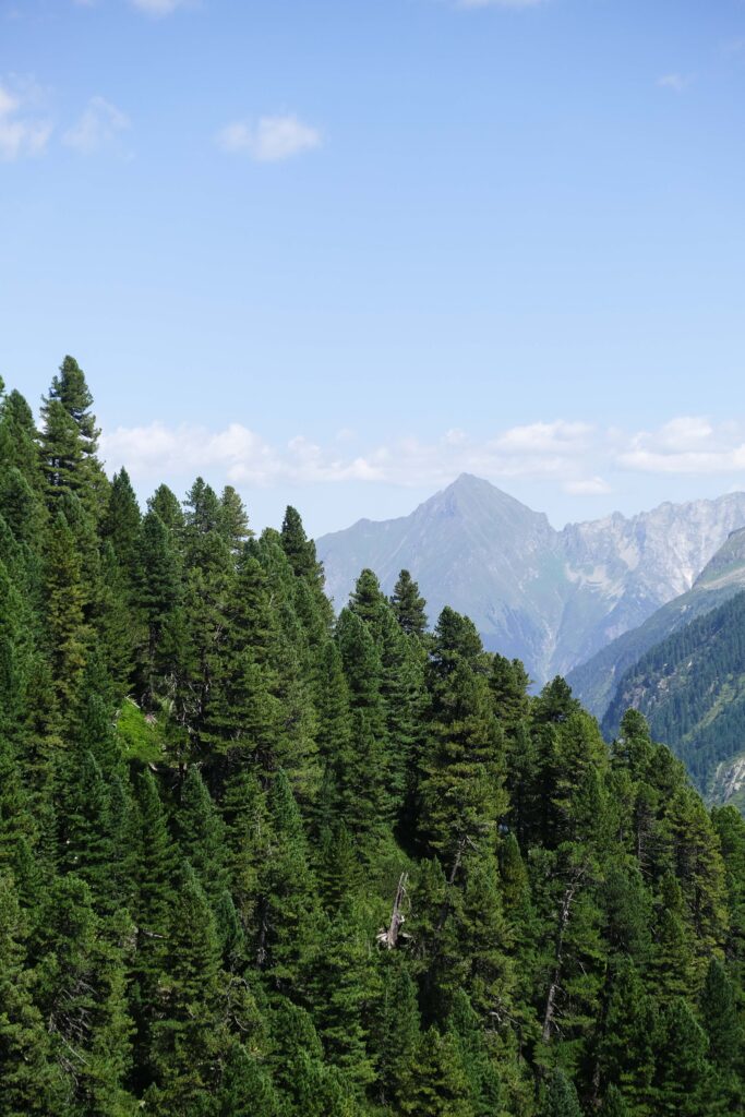
Undoubtedly, one of the most breathtaking hikes in the Zillertal Alps in Tyrol, Austria, is the trail to the Olperer Hut (Olpererhütte) and its iconic suspension bridge. Begin your journey at the Schlegeis Stausee, following well-marked trails through stunning alpine landscapes. Navigate narrow paths and rocky ascents, taking in panoramic views of glacier-fed waters and towering peaks as you approach the Olpererhütte. The suspension bridge, a highlight of the trek, is a stone’s throw from the hut, and crossing it feels like walking on air!
Discover everything you need to know about the Olpererhütte hike in the Austrian Alps.

About the Olpererhütte & The Suspension Bridge
Chances are you’ve already seen the stunning images of the hanging bridge, and that’s what brings you here. However, let us tell you that this should be just an excuse to visit the gorgeous Zillertal Valley. Fed by the Ziller River and nestled within the Zillertal Alps, this is one of the most scenic valleys in all of Tyrol—a perfect destination if you’re looking for a rustic taste of the region.
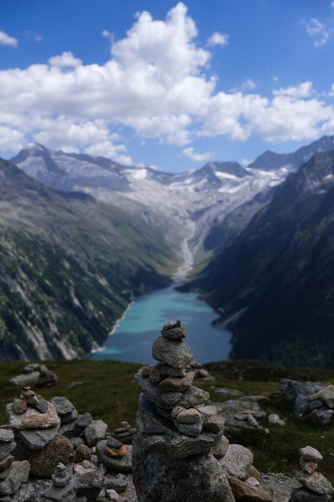
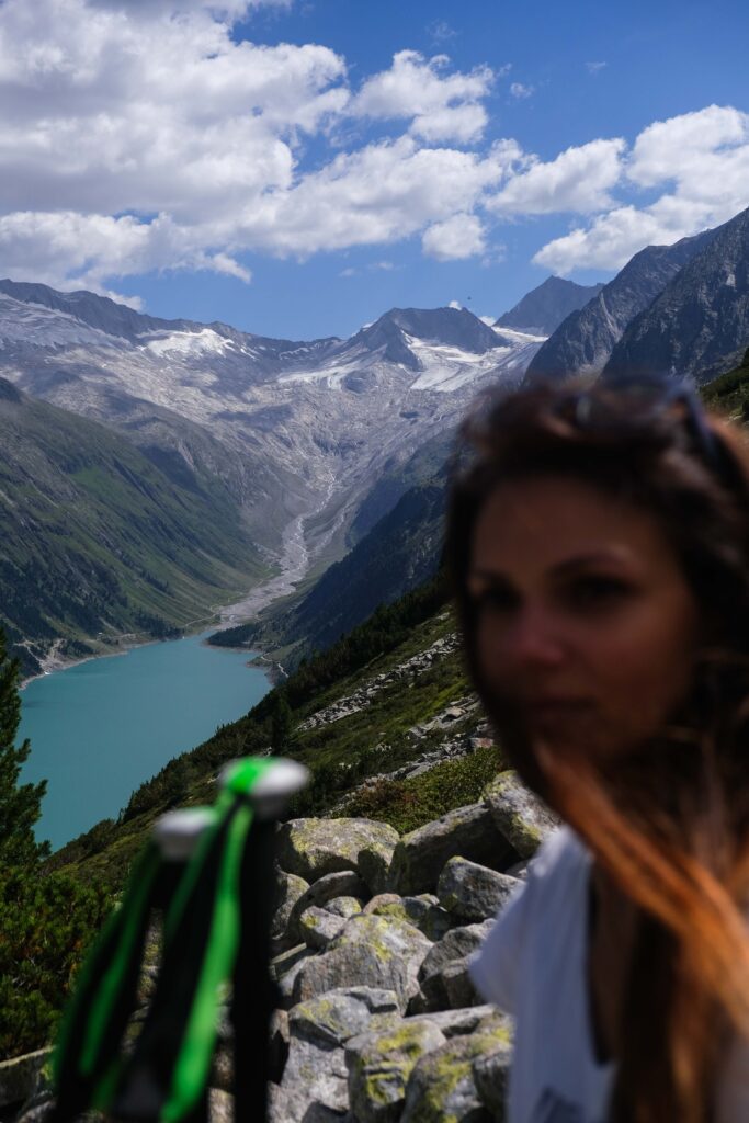
Zillertal boasts no fewer than five reservoirs, known as Speicher or Stausee in German, one of which is the Schlegeis, the starting point of your hike. The Schlegeis Reservoir, featuring a double-curved dam wall 725 meters in length and 131 meters high, is one of the largest reservoirs in Tyrol. To get there, you must follow the Schlegeis Alpine Road, a 13.3km toll road starting from the village of Ginzling and operating only from late May to late October.

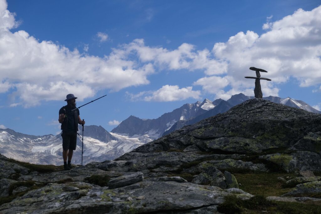
Once you reach the trailhead, you have four different trails to choose from to reach the Olpererhütte, a charming mountain hut perched at a lofty 2,388 meters. The Olpererhütte is one of the huts found along the Berlin High Trail, a long-distance high alpine tour that takes you from hut to hut through the heart of the Zillertal Alps Nature Park and takes seven nights to complete.
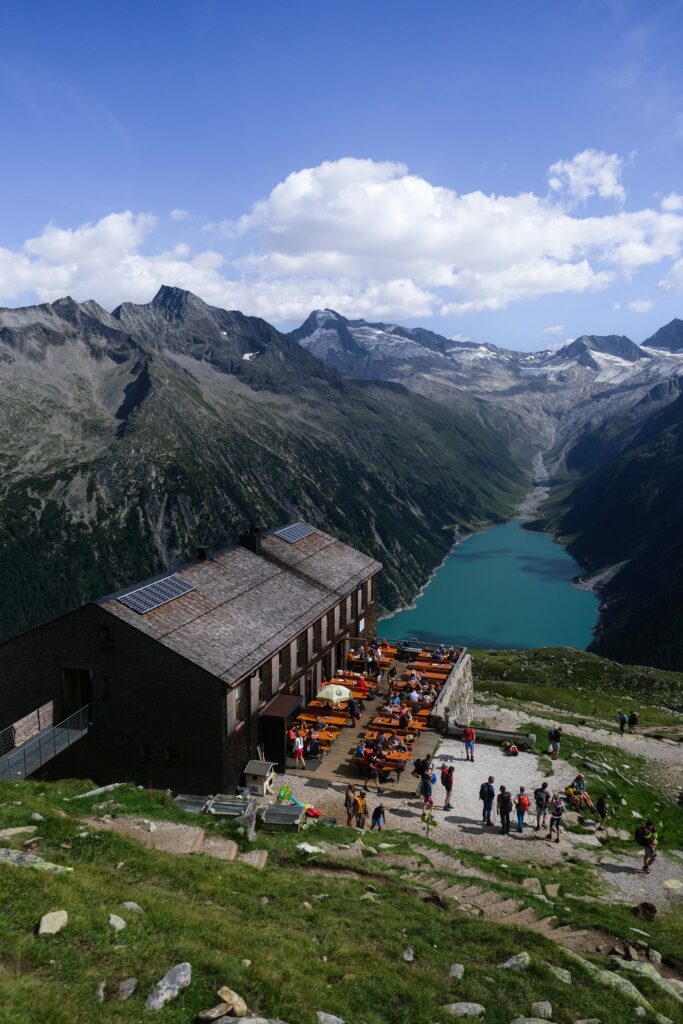
The views from the hut down to the reservoir are spectacular, as is the hearty mountain food served there. Before winding down, you will want to head to the iconic bridge, which is just a short, leisurely five-minute stroll from the hut. Known by many names—Kebema Panoramabrücke, Olperer Panoramabrücke, or Zillertaler Hängebrücke—this bridge is so famous that visiting on a weekend might mean waiting in line for your turn to capture its beauty in a photograph.
From reaching the trailhead to the Olpererhütte, to the various scenic routes you can choose to get there, and even the neighboring huts you’ll encounter along the way, depending on the path you take, here is everything you need to know about your hike.
Olpererhütte Map & Hike Overview
| Difficulty: moderate
| Trailhead: Olpererhütte Hike Trailhead
| Mountain Huts: Dominikushütte, Olpererhütte, Friesenberghaus, Pfitscherjoch-Haus
| When to Visit: June to early October
For specific details on distance, time, and elevation for each of the four available routes, consult the details presented below.

How to Get to the Olpererhütte Trailhead
Getting to the trailhead for the Olpererhütte using public transportation might require a few tweaks, but the region maintains solid connections with other Tyrolean towns, particularly during the active season. If aligning with the last bus back doesn’t quite suit your plans, renting a car might be a better option.
By Train/Bus
Your journey to the captivating Zillertal Valley begins in the little town of Mayrhofen. To reach Mayrhofen from any location within Austria, your route typically involves a transfer at Jenbach Bahnhof, where you switch to a regional train or a local bus.
Upon arrival at Mayrhofen Train Station, proceed to Bus Stand C, located just outside the station. Board Bus #4102, destined for Ginzling Schlegeis Stausee, and disembark at the final stop after approximately 50 minutes.
Tickets: For updated schedules, ticket prices, and reservation details, refer to the ÖBB (Austrian Federal Railways) website or the VVT (Verkehrsverbund Tirol) website. When booking, your final stop is “Schlegeis Stausee”.

| Travel Tip: If you’re traveling with one other person, and are already in Tyrol, consider the VVT Tagesticket Tirol 2Plus option. Costing approximately €35, this ticket facilitates unlimited travel throughout the day of purchase for up to 2 adults and 3 children within the entire Tyrol Association area, excluding long-distance trains.
— Experiencing the Zillertal Steam Train —
For a ride with its own enchantment, consider embarking on a nostalgic journey aboard the venerable Dampfzug, the old steam locomotive that traverses from Jenbach to Mayrhofen. Spanning 32 kilometers in 1.5 hours, this steam-powered marvel whisks you through the captivating Zillertal valley, unfurling a panorama of yesteryears against the backdrop of 100-year-old crimson carriages.
Operating usually from June to September, the steam train offers its unique ride on specific days, with a solitary departure in each direction. For comprehensive fare information and an up-to-date timetable, visit the Zillertalbahn website.
By Car
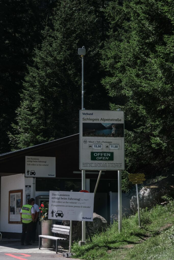
Start by heading to Mayrhofen, and remember that if you drive on the Autobahn, you need a Vignette. From Mayrhofen, head to the hamlet of Ginzling, and upon arrival, follow the signage that points the way to the Schlegeis Speicher. This will lead you onto the Schlegeis Alpenstraße, a 13.3 km toll road that weaves through an array of rugged Alpine landscapes.
Midway through your journey, just before reaching Gasthof Breitlahner, you will encounter the toll station. Here, the cost stands at €17.00 for cars and €13.00 for motorbikes, payable exclusively in cash. An attendant approaches your vehicle to collect the toll. Should cash elude you, fret not – an ATM is available at the site. Be aware that the road’s narrowness prompts the use of a traffic light system, indicating which direction is open. Waiting times of up to 20 minutes might ensue.

| Operating Hours of the Toll Road: The toll road is open daily from late May to late October. During these months, it operates from 07.00 to 18.00, except in June and August, when it opens an hour earlier, at 06.00.
Important note: A driving ban on motorhomes, caravans, and caravan trailers is in place from the toll station at Breitlahner. Please note that minibusses and cars converted into camping vehicles are also affected by the driving ban. Make inquiries before your visit by email or call on tel. +43 (0) 50 313-23 201.
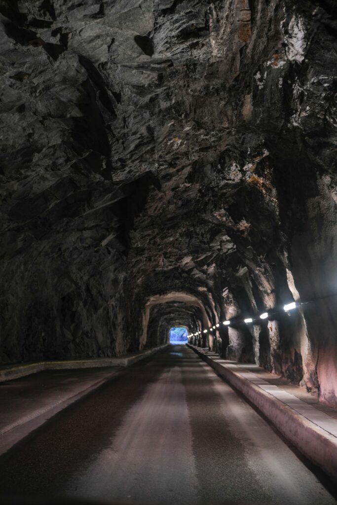
As you ascend the mountainside, the picturesque route embraces eight switchbacks and tunnels through four natural rock formations, each with its own scenic overlook. The grand finale of your drive presents itself as you approach the Schlegeis Reservoir, perched at an elevation of 1,800 meters.
| Parking: There are three parking lots: one shortly after you pass the tunnel, one after about 1km and right at the start of your trailhead, and a third one some 200m further. Opt for the first one only if you are following Route #3 as described below. There is no extra cost for parking but ensure your toll ticket is put in your windshield and visible for inspection.


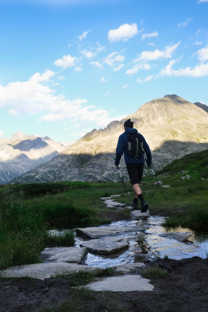
The Hikes to the Olpererhütte
There are four distinct routes to reach the Olpererhütte. And while many favor the direct ascent (Route 1 below) for both going up and coming down, we strongly recommend considering this path for only one direction, ideally on the return journey. For your ascent, we suggest exploring the alternate routes, which lead you to neighboring huts and offer spectacular vistas.
— Ascent Overview —
Route 1: #502
Route 2: #535 followed by #502
Route 3: #532 followed by #526
Route 4: #524 followed by #528 and then #502
— Descent Overview —
Retrace your path to the Schlegeis Speicher by following the direct trail (#502), which corresponds to the same route taken during the ascent detailed in Route 1.
| Route 1 – The Direct Ascent |
The starting point for this hike can be found just across the small parking area. In case the spots are occupied, park at the Schlegeis Stausee car park, a quick 5-minute walk, and head southwest along the reservoir’s shore to the trailhead. Once you’re there, all you need to do is follow the guidance provided by the yellow hiking signs directing you to the Olperer Hütte (Trail #502).
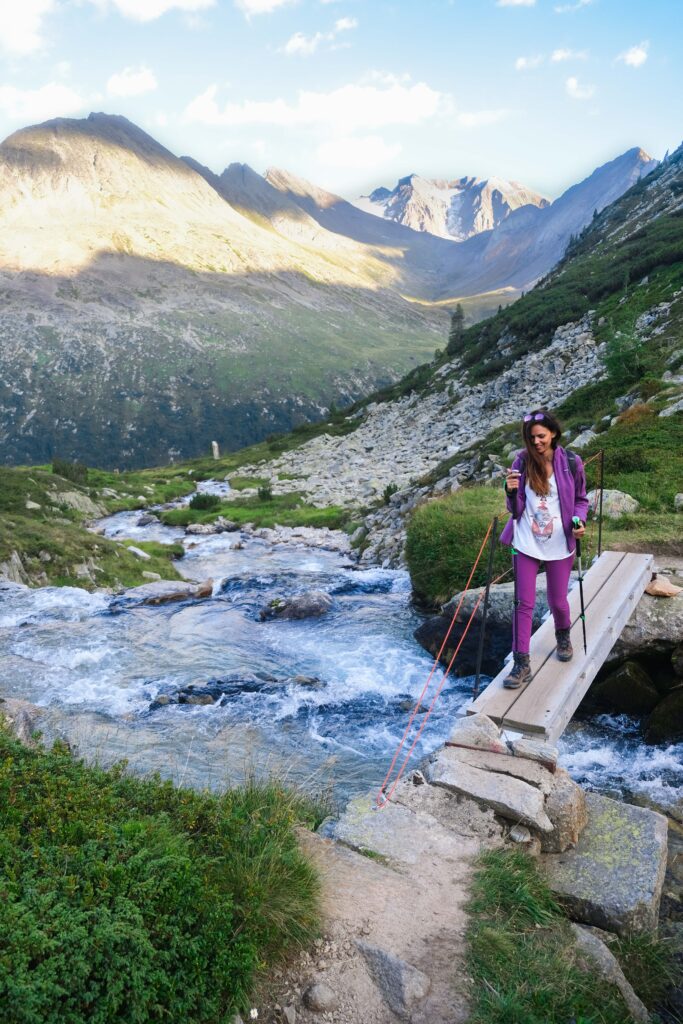
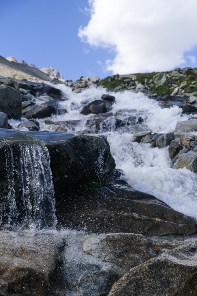
Initially, the trail winds its way through the forest, and although it’s steep, it maintains a relatively even terrain. As you proceed along a zig-zagging ascent, the landscape transforms, growing notably steeper and rockier. The Riepenbach stream flows to your right, leading you closer and closer to the Olpererhütte.


| Route 2 – Ascent via the Neumarkter Runde |
Head towards the trailhead and look for a signpost that points you in the direction of the Olpererhütte via the “Neumarkter Runde.” Follow the indicated path, which corresponds to Trail #535, leading southwest through the forest on a well-constructed pathway adorned with rhododendron and dwarf alpine pine shrubs.
Eventually, you will come across a footbridge that spans the Unterschrammachbach river. Cross the river and continue along the trail, which now ascends more steeply to the northwest, leading you into the expansive open basin of Hinterboden.
Turn right (heading north) onto Route #502, also known as the Central Alpine Way, as you circle around the head of the basin to reach the rocky slopes of Schramerkopf. Stay on the clearly visible rocky path that takes you along the hillside just below Schramerkopf before ending at the Olpererhütte.


| Route 3 – Ascent via the Friesenberghaus |
Schlegeisspeicher to Friesenberghaus (#532):
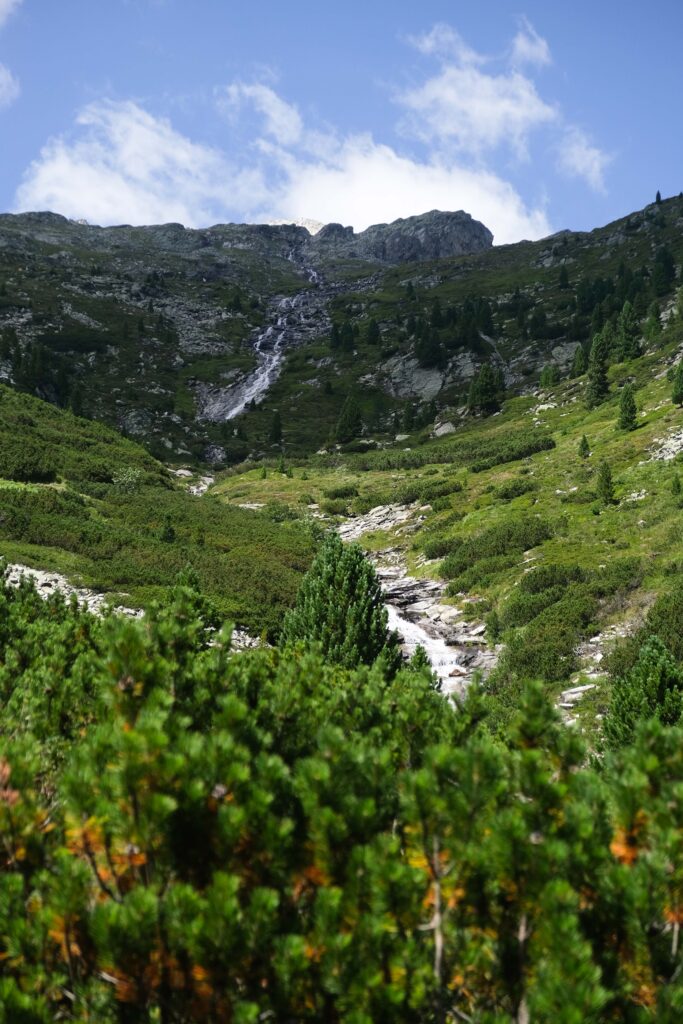
From the first parking lot near Dominikushütte – which also serves as the bus drop-off point – look for a marked intersection indicating a turn towards ‘Friesenberghaus – Berliner Höhenweg.’ As you head northward along Trail #532, you’ll be enveloped by a beautiful pine forest and pass by rivers and waterfalls descending from the mountainside.
Soon, you’ll reach the Lapenkar stream (Lapenkarbach), where a small wooden plank will guide you across the stream, leading you to the right side of the Lapenkar valley. While continuing your ascent, soak in the panoramic views of the surrounding mountains and the distant lake before eventually arriving at the Frieseberg hut.

Friesenberghaus to Olpererhütte (#526):
Commencing at Friesenberghaus, where you’ll find signposts just outside the front door, set your course on Trail #536, directing you westward toward the serene Friesenberg Lake (Friesenbergsee). Your initial descent is brief, and upon crossing a waterway, you’ll ascend to the west, navigating a steep rocky gully in a series of zigzags across challenging sloping rock ledges. This region is often blanketed in snow early in the season, and patches of snow persist through summer.
Shortly thereafter, you’ll arrive at a clearly marked T-junction, denoting the pinnacle of your hike at an elevation of 2,633 meters above sea level. Here, make a left turn and proceed downhill along the picturesque Berliner Höhenweg (Trail #526). This route guides you to the iconic suspension bridge and ultimately to your destination, the Olpererhütte.


| Route 4 – Ascent via the Pfitscherjoch-Haus |
Schlegeisspeicher to Pfitscherjoch-Haus (#524):
From the Schlegeis Stausee car park area, follow Trail #524 by journeying southwest along a single-track graded road. This path intimately follows the right bank of the Zamserbach stream, guiding you 5km along the Via Alpina, a two-hour journey to Pfitscherjoch – the juncture marking the Italian border and the South Tyrol province. As you arrive at the border crossing, distinguished by the presence of the aged customs hut and a roadside chapel, your route now shifts southward, promptly leading you to the Pfitscherjoch-Haus.

Pfitscherjoch-Haus to Olpererhütte (#528):
From the hut, head back to the border crossing and follow the single-track road for about 500m until it turns towards the valley. Here, veer left and pick up the northwest-bound trail on Trail #528. The initial descent takes you across open marshy terrain, leading to a footbridge surrounded by converging streams.
The path then turns more northeasterly, climbing over rocky ground, and passing two prominent stone cairns. Descending from the Ameiskopf ridge, take a right at a sudden halt, proceeding down a rocky slope past small ponds. Upon reaching the junction of Trail #535 and the Neumarkter Runde Höhenweg trail, continue your course along Trail #502 until you reach the Olpererhütte.


Where to Eat During Your Hike
Part of the joy of hiking is indulging in hearty mountain hut cuisine amidst breathtaking vistas. Treat yourself to local favorites like Kaiserschmarrn (fluffy shredded pancake), Spinatknödel (spinach dumplings), Käsespätzle (handmade pasta with melted cheese and fried onions), and Schnitzel.
During your hike, you’ll encounter the Olpererhütte, and depending on your chosen route, you might also pass by the Friesenberghaus (Route #3) or the Pfitscherjoch-Haus (Route #4). Alternatively, consider visiting the Dominikushütte near the trailhead, a short distance from where the bus drops you off and close to one of the parking lots. For lakeside dining, check out Zamsereck and Helmut’s Fischerhütte.


Where to Stay
Mayrhofen is the largest place in the Zillertal, offering a range of accommodations from guesthouses to luxurious resorts. While it can feel touristy, Mayrhofen provides all the amenities you might need. Just before the toll road, the charming mountaineering village of Gizling offers a more quaint experience with simple guesthouses and hostels.
Accommodation in Mayrhofen: ZillergrundRock Luxury Mountain Resort, Gästehaus Hornegger, Der Siegeler B&B – In Gizling: Gasthaus Schwarzenstein, Gasthaus Alt Ginzling, Backyard Mountain Hostel


For a unique experience, however, consider staying in one of the mountain huts along your hiking trail. Spending a night in these alpine refuges can greatly enhance your hiking adventure, allowing you to continue your journey the next morning along the renowned Berlin High Trail. Booking accommodations in advance is essential, especially on weekends when availability can be scarce.
Here are your options:

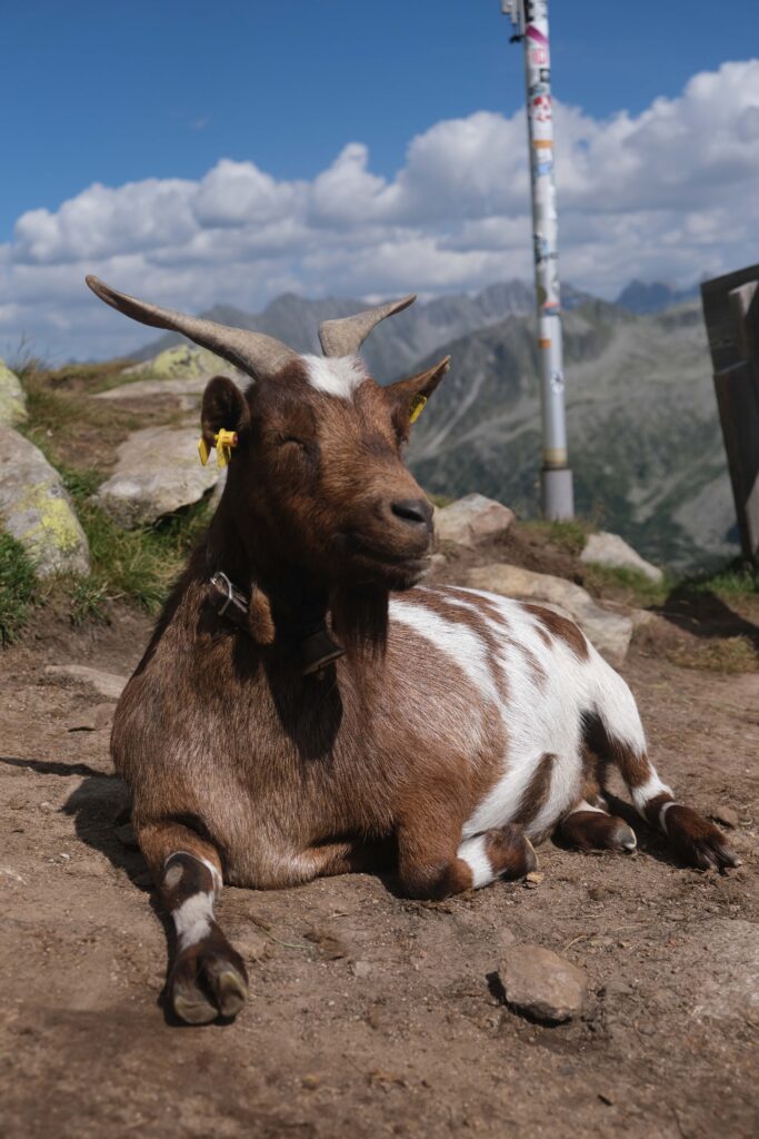
- Olpererhütte (all routes): The ultimate destination of your hike, offering breathtaking views of the lake and a serene atmosphere with free-roaming goats. Accommodations include shared rooms for four and eight people.
- Friesenberghaus (route #3): Located at 2498 meters, this hut operates seasonally from mid-June to mid-September. It offers 32 places in mattress rooms (Matratzenlager) and 34 places in dorm-style rooms (Mehrbettzimmer). It serves as a great hub for exploring the surrounding trails and peaks.
- Pfitscherjoch-Haus (route #4): Situated at 2,276 meters on the Austria-Italy border, this family-run refuge, known as Rifugio Passo di Vizze in Italian, has been welcoming hikers since 1888. It provides basic meals and dormitory-style accommodation, serving as a starting point for cross-border adventures and accessing numerous hiking trails.
- Dominikushütte (all routes): Perched above the Schlegeis reservoir’s parking area, this hut offers panoramic views of the lake and the Schlegeis glacier. Accommodation options include private rooms and dormitories for 4 or 5 guests.

Did you know? The original structure of the Dominikushütte now rests beneath the reservoir, sacrificed for hydroelectric progress. Initially built in 1883, it unexpectedly found itself within Italian territory after World War I, requiring its owners to secure passports for access. Following a complete reconstruction in 1918 due to unexplained fires, it was ultimately lost forever in 1971 when the Schlegeis hydroelectric project submerged the valley.

When to Hike to the Olpererhütte
Choosing the ideal time to embark on your Olpererhütte adventure requires careful consideration of three factors: the operating times of the Schlegeis Alpenstraße, the opening times of the mountain huts, and the ever-fluctuating weather conditions.
In general, the huts operate from late June to early October, overlapping partly with the toll road’s operating season, which typically extends from late May to late October, depending on snow conditions. However, it’s advisable to monitor the official websites of each hut for real-time updates and refer to this website for the operational hours and dates of the Alpine Toll Road.
Regarding trail conditions, high mountain passes and north-facing valleys may retain snow well into July, although it tends to be softer and more manageable by then. June welcomes the arrival of fresh spring foliage, while July showcases picturesque landscapes with vibrant wildflower carpets in full bloom. August offers the most stable weather but coincides with the peak of the Austrian holiday season.
From our perspective, late summer and September emerge as ideal, offering clear, invigorating days with excellent visibility. During this period, the stifling summer humidity recedes, and the trails see fewer hikers, creating a serene atmosphere for your expedition.